Grand Tetons National Park
Jackson Wyoming
June 25th, 2022
![]()
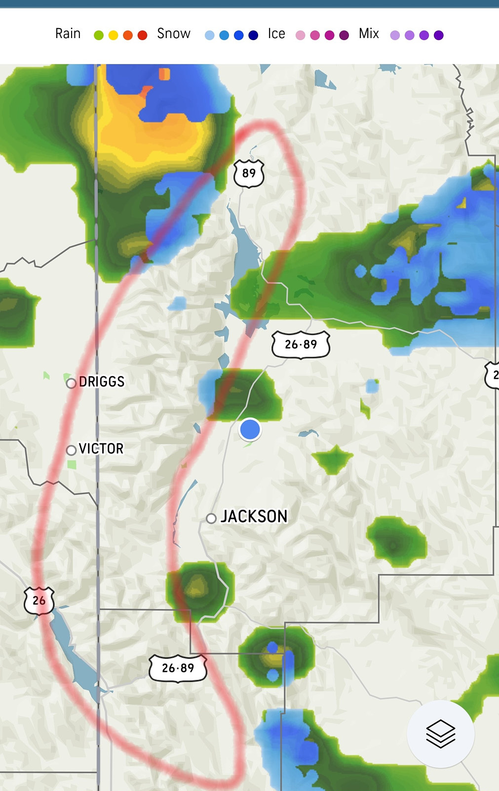
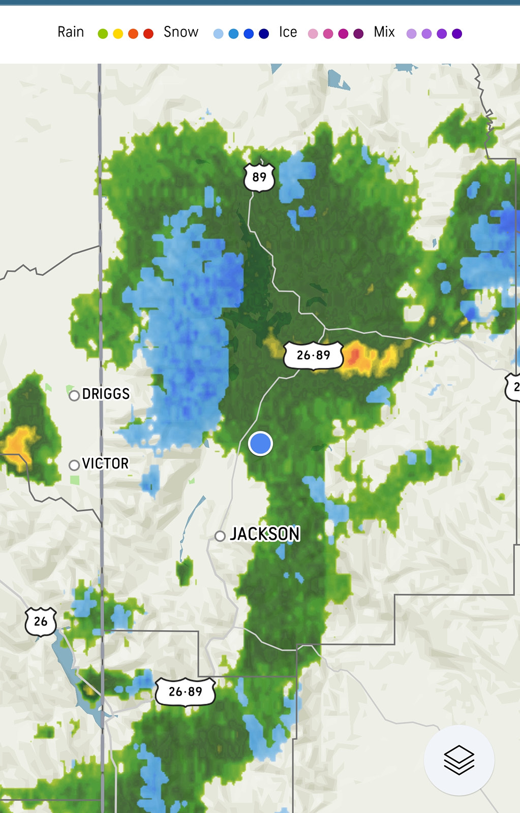
It was forecasted to get up to 85 degrees in Salt Lake City on the day we left, Sunday the 19th. However, as we headed towards Jackson Wyoming the temps started to drop. When we arrived it was 55 and that night it got to 35. This week is supposed to be in the 75/40 temps. A small thunderstorm came through after we set up and on my phones weather map it showed green for rain but it showed blue at the Grand Teton mountains for snow, cool.
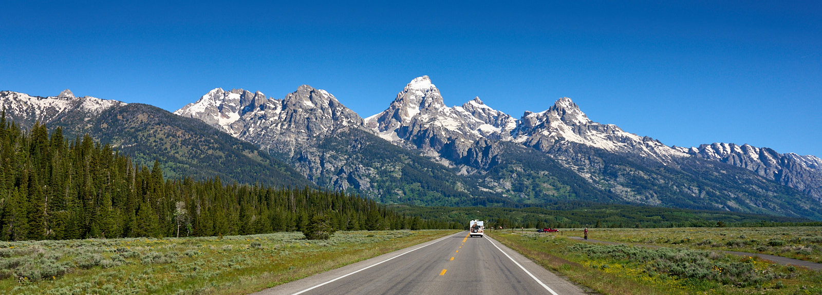
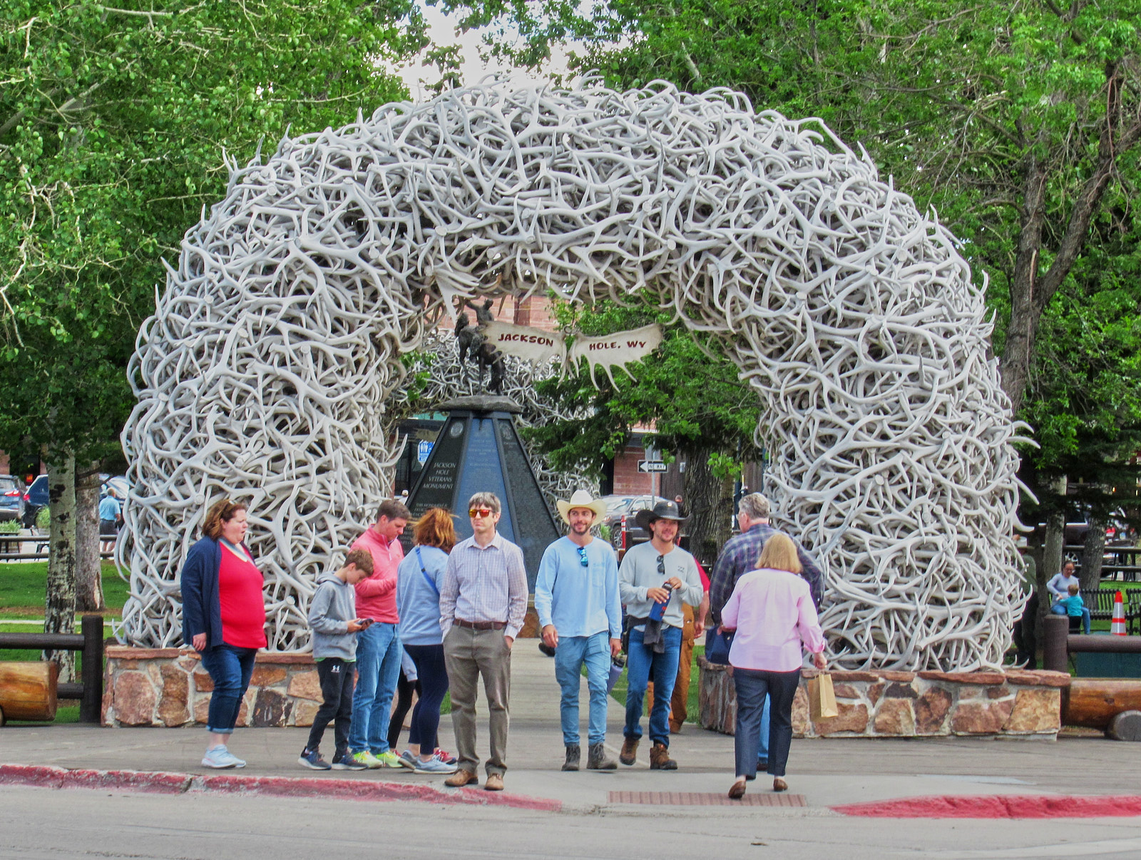
The drive was scenic with rolling large hills, grass lands, and cattle most of the way north, however, once we hit Alpine Wyoming our whole world changed. We went from the hills to mountains of dense forest with 10% grades. The area is the Bridger-Teton Forest with the Snake River running through it. The river is very popular, with 20,000 people visiting it in peak season. We saw several rafts full of people negotiating the rapids in the gray water (snow melt). We had to drive through Jackson to get to the campground, it is definitely a tourist town full of people. Kind of reminded me of Old Town in Albuquerque NM. There is a town square and each of the four corners has an arch made of antlers.

Have you ever seen something on the web or TV that you thought, “I need to visit that place before I die?” Well, here is another iconic photo location. The area is the Morman Row Historic Distric, not too far from our campground, with several barns and the mountains as the back drop. Very cool.
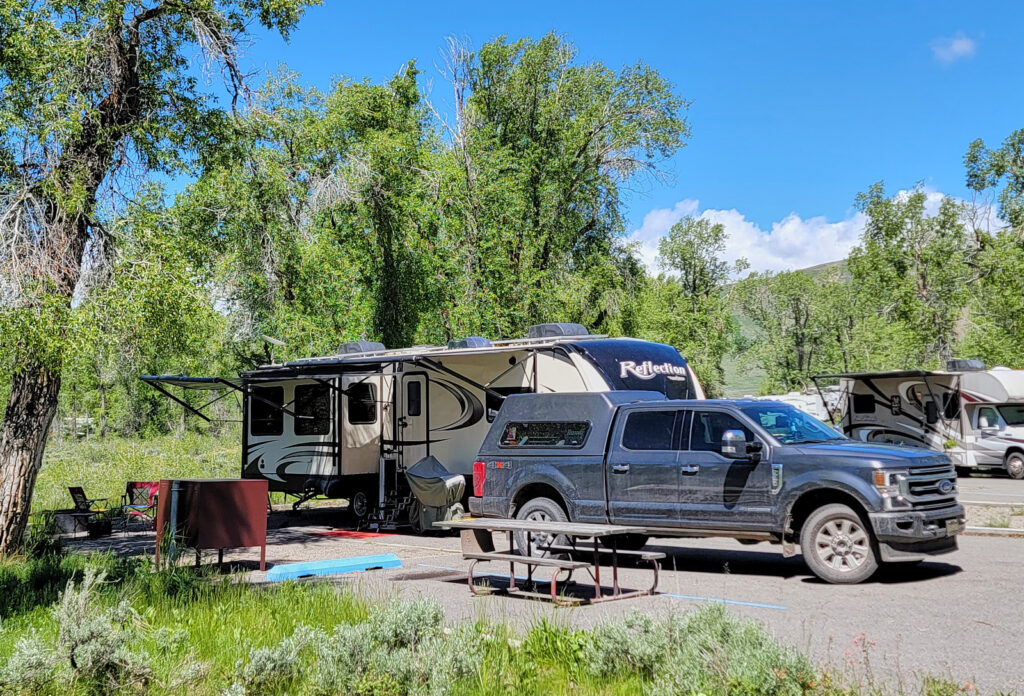
The campground we are staying at is part of the Grand Teton National Park called Gros Ventre (pronounced “grow vant”). We are in a loop that accommodates handicap folks. That means we have 50-amp service. However, there is no water or sewer connections anywhere in the park and no electrtic in any other of the 8 loops. There is a dump station on the way out but we had to make a “reservation” of when we thought we would need to dump as they are managing their resources. There is also a single water spigot at the entrance where we filled up. We are here for a week so the 30-gal water bladder we will use ½ way through our stay will be used for the first time. Each site has a steel brown bear proof box to store things you would normally leave outside. All kinds of wildlife roam the campground including moose (in the photos). We also saw a Grizzly Bear over by Jenny Lake Lodge but did not get a photo.

Grand Tetons National Park for us ranks at top of the favorite list along side Petrified Forest. If fact, it may oust Yellowstone, will wait and see next week. The park is well done, the drive, overlooks, turnouts, scenic drives, etc., just incredible. This section of mountains tower over everything else in the area with large open ranges, huge valley’s, streams with beaver dams, the large slender pine trees at the base of the mountains, the spruce trees, and wildlife… just an amazing and beautiful place. If you are a hiker, this is defiantly the place to go, but bring bear spray.
From the park website:
“The Teton Range contains some of the oldest rocks in North America, similar to those exposed in other major mountain ranges of the western U.S., including the Bighorns, the Gros Ventre and Wind River ranges.
A 2.7 billion-year old metamorphic rock called gneiss makes up much of the Teton Range. These rocks were formed when sea floor sediments and volcanic debris were buried up to 18 miles deep as two tectonic plates collided – similar to the collision of India and Asia today forming the Himalayas. The intense heat and pressure at these great depths changed or metamorphosed the sediments into today’s rocks, separating different minerals into lighter and darker layers.
Molten magma began squeezing into cracks in the gneiss 2.5 billion years ago, and it cooled and crystallized to form igneous granite. This speckled rock with its interlocking crystals is harder than gneiss forming the highest peaks in the central Teton Range – Grand Teton, Middle Teton, and Mount Owen. Other peaks, such as Teewinot and Mount Moran, show stripes of darker and lighter gray where the granite cross-cuts the gneiss.
Roughly 775 million years ago, the region stretched north to south, cracking the deeply buried gneiss and granite and forming a series of vertical, east-west trending cracks. Basaltic magma squirted into these cracks and cooled to form dikes of an igneous rock called diabase. One of these dikes that slices through the face of Mount Moran is 150 feet wide—if the exposed part of the dike melted, the magma would fill Jenny Lake three times over! Black diabase dikes are also visible from the Teton Park Road on the east face of the Middle Teton and the southeast flank of the Grand Teton.”
We leave on Sunday for West Yellowstone. A small town near the west Yellowstone entrance. A few weeks ago Yellowstone was flooding and some of the northern roads were washed out isolating some campgrounds and communities within the park. They immediately closed the entire park. Wednesday of this week they opened up the South section with an entrance rule to curb the crowds. If the last number in your license plate is odd, you can go on an odd day and the same with even. Hopefully this will keeps the crowds manageable.
Catch you in about a week…
![]()
![]()